
Mount Bromo has a crater with a diameter of ± 800 meters (north-south) and ± 600 meters (east-west). While the danger area of a circle with a radius of 4 km from the center of the crater of Bromo.
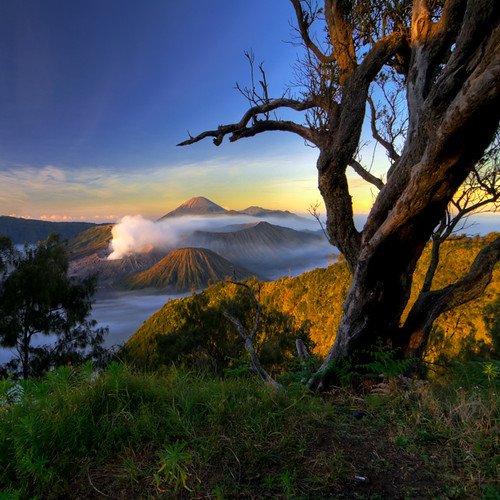
In the sea of sand found seven eruption centers in the two lines intersecting the east-west and northeast-southwest. From the northeast-southwest of Mount Bromo is emerging that includes the active volcanoes that are subject to an eruption of smoke and threaten human life in the vicinity (± 3500 inhabitants).
Bromo Tengger Semeru National Park has a sub-montane ecosystems, montane and sub-Alphin with large trees and hundreds of years old.
Some plant species found in Bromo Tengger Semeru National Park, among others jamuju (Dacrycarpus imbricatus), mountain pine (Casuarina sp.), Eidelweis (Anaphalis javanica), various types of orchids and rare species of grass (Styphelia pungieus).
There are about 137 species of birds, 22 species of mammals and 4 species of reptiles in the park
Endangered and protected animals found in national parks such as cat (Pardofelis marmorata), deer (Cervus timorensis), long-tailed macaques (Macaca fascicularis), deer (Muntiacus muntjak), red jungle fowl (Gallus Gallus), leopard (Panthera pardus), ajag (Cuon alpinus), and various species of birds like the kestrel bird (Accipiter virgatus), hornbill (rhinoceros Buceros silvestris), Bido snake eagle (Spilornis cheela Bido), black Srigunting (Dicrurus macrocercus), Scaly-breasted falcon (Haliasturindustrial), and grouse that live in Ranu Pani, Ranu Regulo, and Ranu Kumbolo.


Bromo Tengger Semeru National Park is the only conservation area in Indonesia which has a unique form of sea sand covering 5250 hectares, which is located at an altitude of ± 2100 meters above sea level.
Tengger tribe around the national park is an indigenous Hindu. According to legend, the origin of the tribe of the Kingdom of Majapahit on retreat. Interestingly, looking at people around (Su-ku Tengger) looked no fear despite knowing of Mount Bromo is dangerous, including the many tourists who visit the Bromo Tengger Semeru National Park at the ceremony Kasodo.

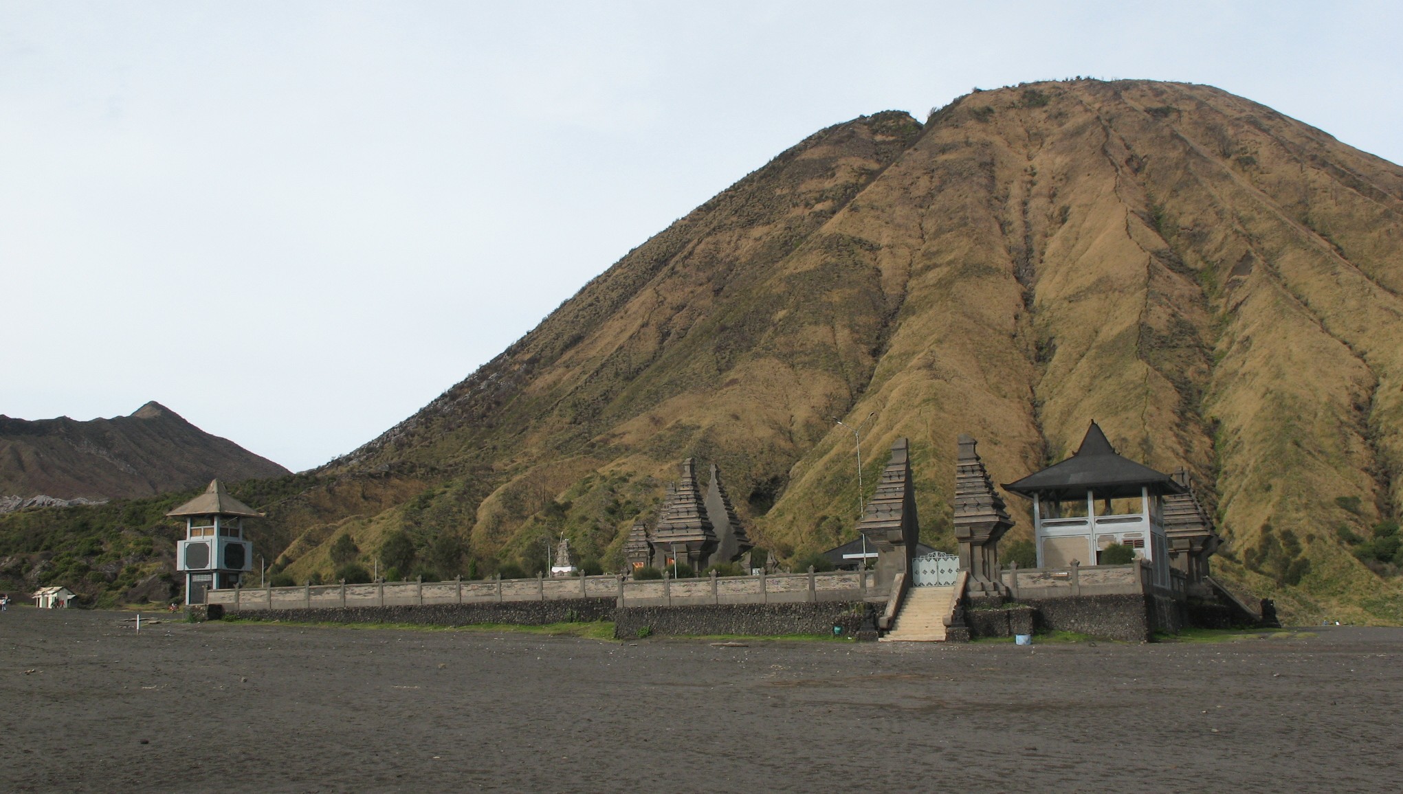
Kasodo ceremony held each year (December / January) at the full moon. Through the ceremony, the Tengger tribe begged or asked for an abundant harvest starting reinforcements and cure of various diseases, in particular by offering to throw offerings into the crater of Mount Bromo, Tengger community while others have reached the crater and down the cliffs to catch offerings thrown into the crater, as a symbolic gift from the Almighty.
Seizing the offerings are an attraction that is very interesting and challenging and scary.Because it is not uncommon among them fell into the crater.
Some sites / attractions to visit:
Cemorolawang. Entrance to one of the most visited national park to see from a distance stretch of sea sand and crater of Bromo, and camping.
Sand Sea and Mount Bromo Tengger. Bromo riding and hiking through the steps and see the sunrise.
Pananjakan. See the scenery of Mount Bromo, Mount Batok and Mount Semeru.
Ranu Pani, Ranu Regulo, Ranu and the summit of Mount Semeru Kumbolo. These lakes are very cold and always foggy (± 2200 m. Above sea level) is often used as a transit point for climbers of Mount Semeru (3676 m. Above sea level).
Ranu Darungan. Camping, observing animals / plants and captivating scenery.
The best visiting season: June to s / d in October and December of s / d Januari.Cara reach the location: Makati-Public-Tosari Dowo Wonokitri-Bromo-use car denganjarak 71 km, Malang-Mixed-Shack-Jemplang Klakah-Mount Bromo using a car with a distance of 53 km, and Jemplang-Ranu Ranu Pani-Kumbolo, 16 km. Or from Malang-Purwodadi-Nongkojajar-Tosari-Wonokitri-Penanjakan approximately 83 km. From Malang to Ranu Pani about 70 minutes by car, which was continued on foot to the summit of Semeru about 13 hours.


Bromo Tanjung Pondok Tani
BalasHapusDalam rangka memperkenalkan " Kawasan Tengger-Bromo" dari segala aspek, menginap di pondok tani tanjung-tosari, ^*DI HARI KERJA CUKUP MAMBAYAR DNG SUKARELA (TANPA TARIF)*^
* rute: pasuruan-warungdowo-ranggeh-pasrepan-puspo-tanjung KM 99.(Tanjung Pondok Tani) -> (Baledono-Tosari)
TARIF HARI LIBUR :
@.kamar los + 2 km mandi luar, dapur, teras serba guna, kapst: 8 s/d 16 orang. Rp.250.000,-/malam.
@.kamar utama + km mandi dalam + perapian, kapst: 4 s/d 6 orang. Rp.150.000,- /malam.
@ fasilitas:.dapur,. kulkas,. ruang makan,. teras serba guna (4 x 12 m),. halaman api unggun,. tempat parkir unt 6 mobil,. kebun sayur.
# hub per sms/tlp: 081249244733 - 085608326673 ( Elie ) 081553258296 (Dudick).
# Informasi di Facebook dengan nama : Bromo Tanjung Pondok Pertanian